Difference between revisions of "Middle La Noscea"
(Created page with ":''Main article: La Noscea'' File:Middle La Noscea Map.jpg") |
(→Vistas) |
||
| (53 intermediate revisions by 11 users not shown) | |||
| Line 1: | Line 1: | ||
:'' | {{Area infobox | ||
[[ | | type = zone | ||
| description = Known for its rolling hills, middle La Noscea borders Galadion Bay. When peering out from Limsa Lominsa, the region seems a pastoral scene. However, a great cliff cleaves the land in twain, a scar left by the Calamity dividing the northern and southern areas. | |||
| within = La Noscea | |||
| levels = 1-17 | |||
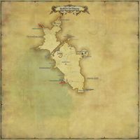
| map = Middle La Noscea Map.jpg | |||
| screenshot = | |||
| aetheryte1 = [[Summerford Farms]];26, 16.5 | |||
| weather = clear skies, fair skies, fog, clouds, rain, wind | |||
| connections = [[Limsa Lominsa Lower Decks]] (SW)<br> [[Lower La Noscea]] (SE)<br>[[Western La Noscea]] (NW)<br>[[Eastern La Noscea]] (SE) | |||
}}<br> | |||
Level 1 [[Striking Dummy|Striking Dummies]] are located at (26.4, 17.2). | |||
{{TOC limit|3}} | |||
== Locations == | |||
{{location table header|Middle La Noscea|showLevel=false}} | |||
|- | |||
| [[Zephyr Drift]] | |||
| | |||
: {{map icon|landmark}} [[Zephyr Gate]] | |||
: {{map icon|landmark}} [[La Thagran Checkpoint]] | |||
: {{map icon|landmark}} [[Galadion Bay]] | |||
: {{map icon|landmark}} [[The Rogue River]] | |||
|- | |||
| [[Summerford]] | |||
| | |||
: {{map icon|landmark}} [[The Agelyss River]] | |||
: {{map icon|landmark}} [[Seasong Grotto]] | |||
: {{map icon|landmark}} [[The Cookpot]] | |||
|- | |||
| {{map icon|settlement}} [[Summerford Farms]] | |||
| | |||
: {{map icon|aetheryte}} Summerford Farms | |||
: {{map icon|chocobokeep}} [[Chocobo Porter]] | |||
: {{map icon|mail}} [[Delivery Moogle]] | |||
|- | |||
| [[Three-malm Bend]] | |||
| | |||
: {{map icon|landmark}} [[The Descent]] | |||
: {{map icon|landmark}} [[The Nym River]] | |||
: {{map icon|landmark}} [[The Skylift]] | |||
: {{map icon|landmark}} [[Woad Whisper Canyon]] | |||
: {{map icon|landmark}} [[The Foremast]] | |||
: {{map icon|landmark}} [[The De Nevelle Checkpoint]] | |||
|} | |||
==Activities== | |||
===Sidequests=== | |||
[[Middle La Noscea Sidequests]] | |||
===FATEs=== | |||
[[Middle La Noscea FATEs]] | |||
==Shops & Services== | |||
{{merchant list|Middle La Noscea}} | |||
==Enemies== | |||
===Normal=== | |||
*[[Bee Cloud]] | |||
*[[Bogy]] | |||
*[[Captain Petyr Pigeontoe]] | |||
*[[Goblin Fisher]] | |||
*[[Goblin Gambler]] | |||
*[[Grounded Pirate]] | |||
*[[Grounded Raider]] | |||
*[[Killer Wespe]] | |||
*[[Little Ladybug]] | |||
*[[Lost Lamb]] | |||
*[[Megalocrab]] | |||
*[[Mossless Goobbue]] | |||
*[[Pugil]] | |||
*[[Puk Hatchling]] | |||
*[[Tiny Mandragora]] | |||
*[[Water Sprite]] | |||
*[[Wespe]] | |||
*[[Wharf Rat]] | |||
*[[Wild Jackal]] | |||
*[[Wounded Aurochs]] | |||
===B Rank=== | |||
*[[Skogs Fru]] | |||
===A Rank=== | |||
*[[Vogaal Ja]] | |||
===S Rank=== | |||
*[[Croque-Mitaine]] | |||
==Vistas== | |||
{{see also|Sightseeing Log}} | |||
Players can unlock the Sightseeing Log by completing the level 20 quest {{questlink|feature|A Sight to Behold}}. After completing the first 20 vistas, players can unlock the remaining vistas by talking to the NPC [[Millith Ironheart]] in [[Old Gridania]] (X:10.7, Y:6.0). | |||
{| {{STDT|location sortable align-left}} | |||
|- | |||
! # | |||
! Name | |||
! Zone | |||
! Coordinate | |||
! Weather | |||
! data-sort-type=number | Time | |||
! Emote | |||
! Comment | |||
|- | |||
| 3 || [[Sightseeing Log 3: Seasong Grotto|Seasong Grotto]] ||[[Middle La Noscea]] || (X:20.3, Y:19.1) || {{weather icon|rain}} [[Rain]] <br> {{weather icon|showers}} [[Showers]] || 5:00-8:00 || {{action icon|Pray}} || In the Seasong Grotto, by the entrance. Vista is close to the end of the tunnel leading into the cave, You'll want to stand in the middle of the end of the tunnel, as that's where the message will appear. | |||
|- | |||
| 4 || [[Sightseeing Log 4: The Skylift|The Skylift]] ||[[Middle La Noscea]] || (X:16.0, Y:17.3)|| {{weather icon|fair skies}} [[Fair Skies]] <br> {{weather icon|clear skies}} [[Clear Skies]] || 12:00-17:00 || {{action icon|Lookout}} ||By the Skylift, next to the NPC overlooking the pier. | |||
|- | |||
| 5 || [[Sightseeing Log 5: La Thagran Eastroad|La Thagran Eastroad]] ||[[Middle La Noscea]] || (X:25.3, Y:27.5)|| {{weather icon|clouds}} [[Clouds]] || 8:00-12:00 || {{action icon|Lookout}} ||Go up the stairs on the east side, and jump up onto the fence post at the top of the stairs. | |||
|- | |||
| 21 || [[Sightseeing Log 21: Woad Whisper Canyon| Woad Whisper Canyon]] ||[[Middle La Noscea]] || (X:20.0, Y:13.1) || {{weather icon|fair skies}} [[Fair Skies]] <br> {{weather icon|clear skies}} [[Clear Skies]] || 12:00-17:00 || {{action icon|Lookout}} ||Edge of the path, before you pass under the rocky archways. | |||
|- | |||
| 22 || [[Sightseeing Log 22: Summerford Farms| Summerford Farms]] ||[[Middle La Noscea]] || (X:25.7, Y:17) || {{weather icon|fair skies}} [[Fair Skies]] <br> {{weather icon|clear skies}} [[Clear Skies]] || 5:00-8:00 || {{action icon|Lookout}} ||Second floor of Inn. Top of lamp to left of door. Jump on pot plant, then to partition, then to top of lamp. | |||
|- | |||
|} | |||
==Achievements== | |||
This zone is associated with the following achievements: | |||
{| {{STDT| mech1 sortable align-left}} | |||
{{achievement table header}} | |||
{{achievement table row|Mapping the Realm: Middle La Noscea}} | |||
|} | |||
==Images== | |||
<gallery mode=packed> | |||
ARR new location6.jpg | |||
Middle La Noscea1.jpg | |||
Middle La Noscea2.jpg | |||
Middle La Noscea3.jpg | |||
Middle La Noscea Map Fishing.jpg|Fishing Holes | |||
</gallery> | |||
==Lore== | |||
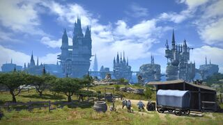
Known for its rolling hills, middle La Noscea borders Galadion Bay. When peering out from Limsa Lominsa, the region seems a pastoral scene. However, a great cliff cleaves the land in twain, a scar left by the Calamity dividing the northern and southern areas. | |||
===Zephyr Drift=== | |||
This grassland begins just past the Zephyr Gate, and gains its title from the same westerly breeze as the egress. | |||
====Galadion Bay==== | |||
Galadion Bay was named in honor of the great vessel that bore Limsa Lominsa’s founders from the northern seas to their new home. Scholars have recently discovered that it was known as the Bay of Nym in the Fifth Astral Era. | |||
====The Rogue River==== | |||
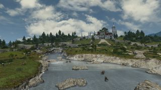
One of three streams that flow through middle La Noscea, the Rogue River did not exist until the Calamity sundered the ground and opened up a new path for the water. Thieves used the river to transport their ill-gotten goods in the early Seventh Umbral Era, and their activities gave the waterway its present name. | |||
====The La Thagran Checkpoint==== | |||
The Maelstrom set up this checkpoint to keep watch over the La Thagran Eastroad that cuts through middle La Noscea. The Grand Company has since entrusted the post to the Yellowjackets, as the area rarely sees kobold encroachment. | |||
===Summerford=== | |||
When the Calamity carved rifts in the land’s surface, water rushed up to fill them from a subterranean vein flowing forth from the mountains of O’Ghomoro. Two new rivers now run through middle La Noscea, and have turned the area betwixt them into a fertile farmland where produce always grows in the abundance of summer. Summerford is also known as the former home of Camp Bearded Rock, a Yellowjacket outpost that was purged from La Noscea, rock and all, when Bahamut unleashed his flames upon the area. | |||
====Summerford Farms==== | |||
When Merlwyb Blocfhiswyn rose to Admiral, one of her first decrees included the clearing of large swaths of land for new Lominsan settlements. Summerford Farms and its expansive orange groves is one of those locations—its name is derived from the man-made crossings required when late spring runoff from Mt. O’Ghomoro causes the Rogue River to swell. | |||
====Seasong Grotto==== | |||
“I am the waves that bear, I am the winds that guide. I am the evening stars, I am the morning sky. I am born of the sea, and there shall I die.” | |||
Nestled within a shallow cavern situated to the south of Summerford Farms sits an ancient monolith upon which is carved this, the Sailors’ Requiem. | |||
====The Agelyss River==== | |||
Flowing from the direction of Agelyss Wise, this river is the second of those created by the Calamity. | |||
====The Cookpot==== | |||
As this patch of land is encircled by a queer wall of stone, the locals have taken to calling it the Cookpot—and worrying over what trouble stews inside. | |||
===Three-Malm Bend=== | |||
A curved section of land some three malms long, this area straddles the rift known as the Descent. Its lowest point sits but barely above the level of the seas. | |||
====The Descent==== | |||
A deep scar left by the Calamity, this mighty rift swallowed the Nym River and the land it once flowed through—and with it, countless lives. Thus, the Descent was given its ominous sounding name so that no more would stumble over the precipice to be dashed upon the rocks below. | |||
====The Skylift==== | |||
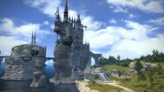
Once an endless expanse of flat, rocky meadows, middle La Noscea is now severed by a sheer cliff known as the Descent. To maintain overland trade routes from the easterly outposts of Aleport and Bronze Lake, Lominsan engineers created the Skylift—a tower of wooden scaffolding outfitted with pulleys, winches, and lighter-than-air balloons. | |||
====The De Nevelle Checkpoint==== | |||
From the De Nevelle Checkpoint, the Maelstrom keeps vigil over the road to the hamlet Wineport. In order to watch for the Garlean forces that have advanced into eastern La Noscea, the post is far more heavily manned than the La Thagran Checkpoint. | |||
====Woad Whisper Canyon==== | |||
Little more than a shallow valley but five years past, Woad Whisper Canyon was carved into a gaping gorge in a matter of moons after the Calamity drained Bronze Lake and dramatically altered the course of the Nym River. On hot days, laborers from both Summerford Farms and the Skylift will oft take respite in the cool mists of the falls...if not met by bandits. | |||
====The Nym River==== | |||
Flowing forth from Bronze Lake, this river has been named in honor of the ancient Nymian temple discovered in its headwater. | |||
====The Foremast==== | |||
The newest Yellowjacket watchtower, the Foremast, leads into the capital proper—though no adventurer is permitted entry this way. Like the Mizzenmast, its name hearkens back to the nautical, and indicates not only the mast standing nearest a ship’s bow, but Limsa Lominsa’s resolve to lead the fight. | |||
<ref>Encyclopaedia Eorzea: Volume I, page 106</ref> | |||
==References== | |||
<references /> | |||
{{Zone nav}} | |||
Latest revision as of 07:51, 15 October 2023
Middle La Noscea
- Levels
- 1 – 17
- Type
- Zone
- Zone
- La Noscea
(Vylbrand) - Connects to
- Limsa Lominsa Lower Decks (SW)
Lower La Noscea (SE)
Western La Noscea (NW)
Eastern La Noscea (SE) - Aetherytes
- Summerford Farms (X:26, Y:16.5)
“Known for its rolling hills, middle La Noscea borders Galadion Bay. When peering out from Limsa Lominsa, the region seems a pastoral scene. However, a great cliff cleaves the land in twain, a scar left by the Calamity dividing the northern and southern areas.
— In-game description
Middle La Noscea is a zone in La Noscea.
Level 1 Striking Dummies are located at (26.4, 17.2).
Locations
| Area | Points of Interest |
|---|---|
| Zephyr Drift | |
| Summerford | |
| Summerford Farms |
|
| Three-malm Bend |
Activities
Sidequests
FATEs
Shops & Services
| Merchant Name | Merchant Location |
|---|---|
| Merchant & Mender | (X:25.5, Y:17.3) |
Enemies
Normal
- Bee Cloud
- Bogy
- Captain Petyr Pigeontoe
- Goblin Fisher
- Goblin Gambler
- Grounded Pirate
- Grounded Raider
- Killer Wespe
- Little Ladybug
- Lost Lamb
- Megalocrab
- Mossless Goobbue
- Pugil
- Puk Hatchling
- Tiny Mandragora
- Water Sprite
- Wespe
- Wharf Rat
- Wild Jackal
- Wounded Aurochs
B Rank
A Rank
S Rank
Vistas
- See also: Sightseeing Log
Players can unlock the Sightseeing Log by completing the level 20 quest ![]() A Sight to Behold. After completing the first 20 vistas, players can unlock the remaining vistas by talking to the NPC Millith Ironheart in Old Gridania (X:10.7, Y:6.0).
A Sight to Behold. After completing the first 20 vistas, players can unlock the remaining vistas by talking to the NPC Millith Ironheart in Old Gridania (X:10.7, Y:6.0).
| # | Name | Zone | Coordinate | Weather | Time | Emote | Comment |
|---|---|---|---|---|---|---|---|
| 3 | Seasong Grotto | Middle La Noscea | (X:20.3, Y:19.1) | Rain Showers |
5:00-8:00 | Pray | In the Seasong Grotto, by the entrance. Vista is close to the end of the tunnel leading into the cave, You'll want to stand in the middle of the end of the tunnel, as that's where the message will appear. |
| 4 | The Skylift | Middle La Noscea | (X:16.0, Y:17.3) | Fair Skies Clear Skies |
12:00-17:00 | Lookout | By the Skylift, next to the NPC overlooking the pier. |
| 5 | La Thagran Eastroad | Middle La Noscea | (X:25.3, Y:27.5) | Clouds | 8:00-12:00 | Lookout | Go up the stairs on the east side, and jump up onto the fence post at the top of the stairs. |
| 21 | Woad Whisper Canyon | Middle La Noscea | (X:20.0, Y:13.1) | Fair Skies Clear Skies |
12:00-17:00 | Lookout | Edge of the path, before you pass under the rocky archways. |
| 22 | Summerford Farms | Middle La Noscea | (X:25.7, Y:17) | Fair Skies Clear Skies |
5:00-8:00 | Lookout | Second floor of Inn. Top of lamp to left of door. Jump on pot plant, then to partition, then to top of lamp. |
Achievements
This zone is associated with the following achievements:
| Name | Points | Task | Reward | Patch |
|---|---|---|---|---|
| Mapping the Realm: Middle La Noscea | 10 | Visit middle La Noscea and unlock the area map. | - | 2.1 |
Images
Lore
Known for its rolling hills, middle La Noscea borders Galadion Bay. When peering out from Limsa Lominsa, the region seems a pastoral scene. However, a great cliff cleaves the land in twain, a scar left by the Calamity dividing the northern and southern areas.
Zephyr Drift
This grassland begins just past the Zephyr Gate, and gains its title from the same westerly breeze as the egress.
Galadion Bay
Galadion Bay was named in honor of the great vessel that bore Limsa Lominsa’s founders from the northern seas to their new home. Scholars have recently discovered that it was known as the Bay of Nym in the Fifth Astral Era.
The Rogue River
One of three streams that flow through middle La Noscea, the Rogue River did not exist until the Calamity sundered the ground and opened up a new path for the water. Thieves used the river to transport their ill-gotten goods in the early Seventh Umbral Era, and their activities gave the waterway its present name.
The La Thagran Checkpoint
The Maelstrom set up this checkpoint to keep watch over the La Thagran Eastroad that cuts through middle La Noscea. The Grand Company has since entrusted the post to the Yellowjackets, as the area rarely sees kobold encroachment.
Summerford
When the Calamity carved rifts in the land’s surface, water rushed up to fill them from a subterranean vein flowing forth from the mountains of O’Ghomoro. Two new rivers now run through middle La Noscea, and have turned the area betwixt them into a fertile farmland where produce always grows in the abundance of summer. Summerford is also known as the former home of Camp Bearded Rock, a Yellowjacket outpost that was purged from La Noscea, rock and all, when Bahamut unleashed his flames upon the area.
Summerford Farms
When Merlwyb Blocfhiswyn rose to Admiral, one of her first decrees included the clearing of large swaths of land for new Lominsan settlements. Summerford Farms and its expansive orange groves is one of those locations—its name is derived from the man-made crossings required when late spring runoff from Mt. O’Ghomoro causes the Rogue River to swell.
Seasong Grotto
“I am the waves that bear, I am the winds that guide. I am the evening stars, I am the morning sky. I am born of the sea, and there shall I die.”
Nestled within a shallow cavern situated to the south of Summerford Farms sits an ancient monolith upon which is carved this, the Sailors’ Requiem.
The Agelyss River
Flowing from the direction of Agelyss Wise, this river is the second of those created by the Calamity.
The Cookpot
As this patch of land is encircled by a queer wall of stone, the locals have taken to calling it the Cookpot—and worrying over what trouble stews inside.
Three-Malm Bend
A curved section of land some three malms long, this area straddles the rift known as the Descent. Its lowest point sits but barely above the level of the seas.
The Descent
A deep scar left by the Calamity, this mighty rift swallowed the Nym River and the land it once flowed through—and with it, countless lives. Thus, the Descent was given its ominous sounding name so that no more would stumble over the precipice to be dashed upon the rocks below.
The Skylift
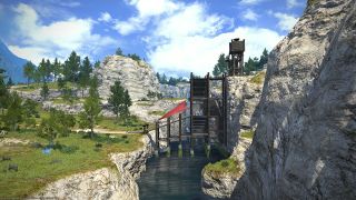
Once an endless expanse of flat, rocky meadows, middle La Noscea is now severed by a sheer cliff known as the Descent. To maintain overland trade routes from the easterly outposts of Aleport and Bronze Lake, Lominsan engineers created the Skylift—a tower of wooden scaffolding outfitted with pulleys, winches, and lighter-than-air balloons.
The De Nevelle Checkpoint
From the De Nevelle Checkpoint, the Maelstrom keeps vigil over the road to the hamlet Wineport. In order to watch for the Garlean forces that have advanced into eastern La Noscea, the post is far more heavily manned than the La Thagran Checkpoint.
Woad Whisper Canyon
Little more than a shallow valley but five years past, Woad Whisper Canyon was carved into a gaping gorge in a matter of moons after the Calamity drained Bronze Lake and dramatically altered the course of the Nym River. On hot days, laborers from both Summerford Farms and the Skylift will oft take respite in the cool mists of the falls...if not met by bandits.
The Nym River
Flowing forth from Bronze Lake, this river has been named in honor of the ancient Nymian temple discovered in its headwater.
The Foremast
The newest Yellowjacket watchtower, the Foremast, leads into the capital proper—though no adventurer is permitted entry this way. Like the Mizzenmast, its name hearkens back to the nautical, and indicates not only the mast standing nearest a ship’s bow, but Limsa Lominsa’s resolve to lead the fight. [1]
References
- ↑ Encyclopaedia Eorzea: Volume I, page 106
